Geoscience and AI
Overview
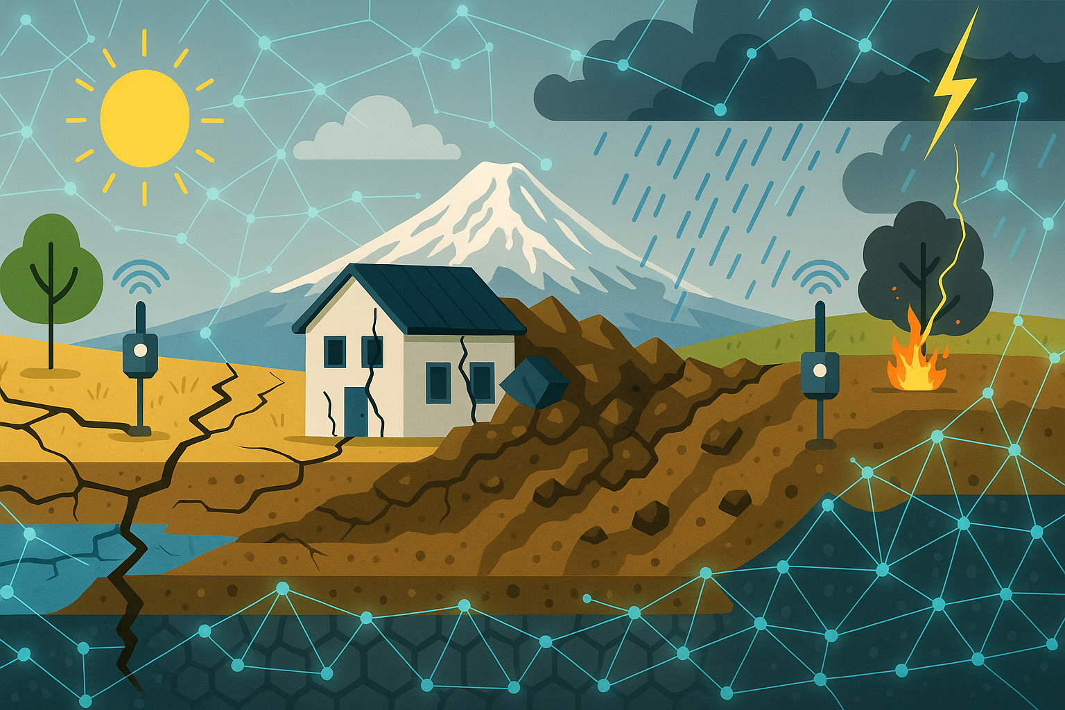
We are interested in leveraging AI advancements, the rise of sensor data, and state-of-the art scientific knowledge can support a predictive understanding of geohazards (earthquake ground motions, landslides, flash floods, wildfires) in a changing climate.
We develop AI tools for:
- Physics-aware reduced order models of complex physics (e.g., wavefield simulations).
- Event monitoring, developing deep learning models to detect, classify, and characterize geohazards from geophysical sensor data.
- Develop data fusion methods for gridded data set (imagery or models) with time series data.
- Develop data assimilation framework for forecasting these hazards.
- Develop agentic framework to automate research workflow and cross disciplinary boundaries.
Our style of research is to have minimal neural network architectures for low cost development and interpretability, so that they can be applied on peta-scale data at low cost.
Research Focus
Our Geoscience-AI research spans several interdisciplinary domains:
- Physics-Aware Machine Learning
- Earth System Modeling for Extreme Event, especially in compounding-cascading hazard assessments
- Data fusion of imagery and in-situ sensor data
- Agentic Framework to cross disciplinary boundaries
Key Papers
- Xiao et al., (2026)
- Kharita et al., (2026)
- Yermakov et al., (2026)
- Ni et al., (2025)
- Denolle et al., (2025)
- Shi et al., (2025)
- Ni et al., (2024)
- Ni et al., (2023)
- Kharita et al., (2023)
- Shi et al., (2023)
- Ni et al., (2023)
- Perol et al., (2018)